


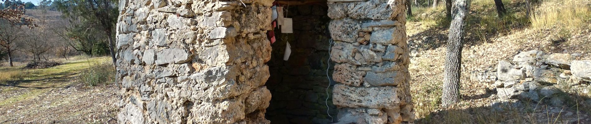
chapeiie st michel le vieux cannet

chrifor
User
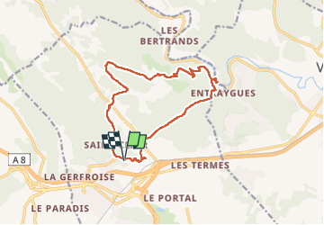

Length
15.4 km

Max alt
242 m

Uphill gradient
389 m
Km-Effort
21 km

Min alt
64 m

Downhill gradient
394 m
Boucle
Yes
Creation date :
2023-02-14 08:53:06.363
Updated on :
2023-02-14 15:31:01.181
4h22
Difficulty : Medium

FREE GPS app for hiking
 SityTrail
IGN / Geographical institutes
SityTrail Plus
The world is yours!
About
Trail Walking of 15.4 km to be discovered at Provence-Alpes-Côte d'Azur, Var, Le Cannet-des-Maures. This trail is proposed by chrifor.
Photos


Positioning
Country:
France
Region :
Provence-Alpes-Côte d'Azur
Department/Province :
Var
Municipality :
Le Cannet-des-Maures
Location:
Unknown
Start:(Dec)
Start:(UTM)
285171 ; 4808796 (32T) N.
Comments